Monitoring the Marine Radar
Posted on 12 July 2021 by RJ Saftescu 

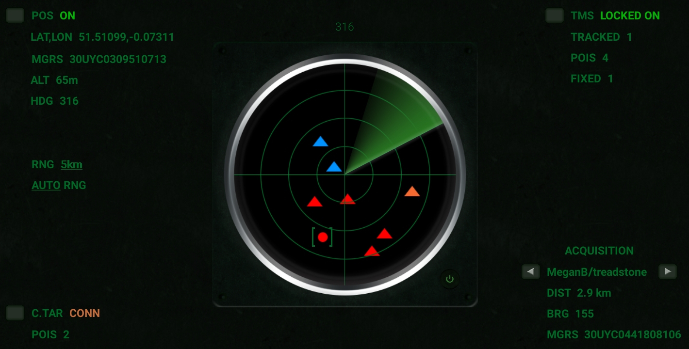
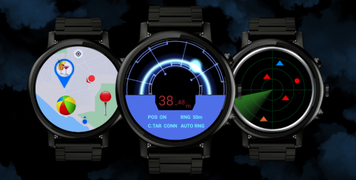
Thanks to its polyvalent role as a dashboard that combines user-centric as well as target-related information, the operator may choose it as the interface of choice for situational awareness.
The Marine Radar may be used in a specific capacity as part of a focused workflow – such as navigating to a specific position, or obtaining its geographic coordinates via the ACQUISITION section located in the bottom right-hand quadrant – when not purely for the purpose of passive monitoring, to track targets' moving positions or Points Of Interest manifesting themselves as incoming marker signals.

The modularity of the Marine Radar is reinforced by the presence of buttons providing direct access to the Position Service, Connected Target and Target Management System screens.
Watch a demo of the Marine Radar locking on a target, and then acquiring its position:
A decisive advantage of the Marine Radar lies in its ability to display fixed positions without the internet – which might come in handy in certain circumstances.
Only then requiring a GPS signal, it can still be used in a consistently accurate way in order for example to display the relative positions of pre-saved lists of items, or to mark coordinates received over the radio and added via the Target Management System.
Positions received over the radio would be either manually entered by the human operator receiving an MGRS coordinate for instance, or automatically registered by LockOnMe if using its experimental DTMF functionality (see the DTMF section of the User Guide for more information on that particular topic).
You can find more information on the Marine Radar in the Display section of the User Guide![]() : markers legend, logic of the range attribute, etc.
: markers legend, logic of the range attribute, etc.
°•◦♠♡♢♣♤♥♦♧●◯


