User GuideThe Web Tracking Console (WTC)
This web interface is accessible at lockon.me![]() .
.
The targets and fixed positions processed in the console are dynamically reflected in its URL (as parameters) – making it easy to share positions with someone else by sharing the URL.
On Android devices, a button appears in the top right-hand corner of the webpage to view the tracking items of the console in the LockOnMe mobile app.
80+ map styles are currently available (switchable via the layers icon in the top right-hand corner of the map) – check them out!
The functionalities of the tracking console are accessible via the four tabs on top of the map: Tracking, Public Targets, Reticle and Conversions.
The WTC can be used to display targets' broadcast locations and/or Points Of Interest (POIs):
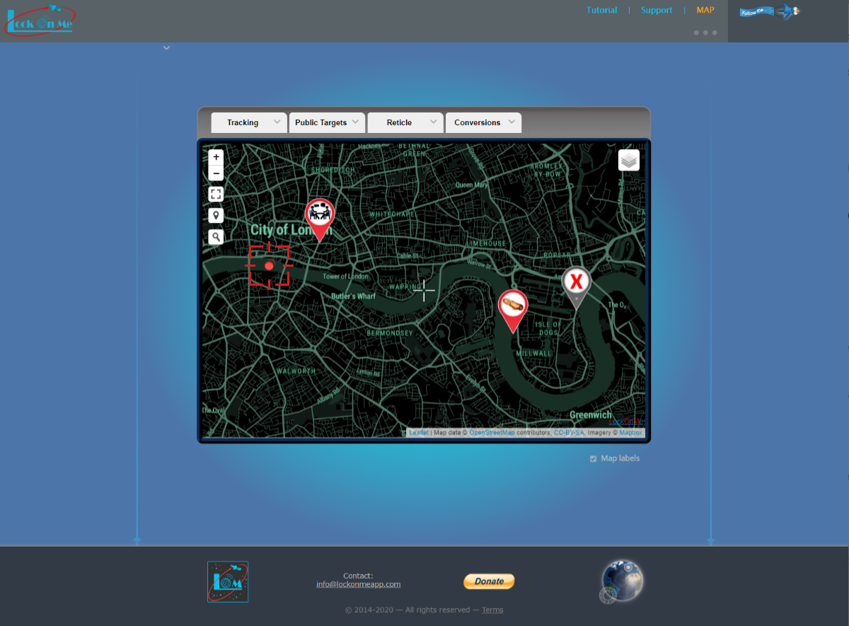
This can be achieved in two ways:
- via direct URL:
URL parameters can store target details and other attributes (such as the map style), so you could link to your target in this way for example:
The lat and lon parameters are optional; their role is to provide the initial coordinates when loading the map (instead of centering on the user's IP geolocation by default when things take longer to load), before it auto-pans and zooms to display the items of interest. When used in conjunction with the initial zoom level z, it can also add a certain sense of animation.
It is possible to track multiple targets simultaneously like so:
...&track=(MeganB/treadstone),(alpha1/session1)The brackets ( ) surrounding the target details are optional.
- by adding targets manually (which would update the URL dynamically):
Click on the Tracking tab to expand it, then on the Track button, and fill in the target details:
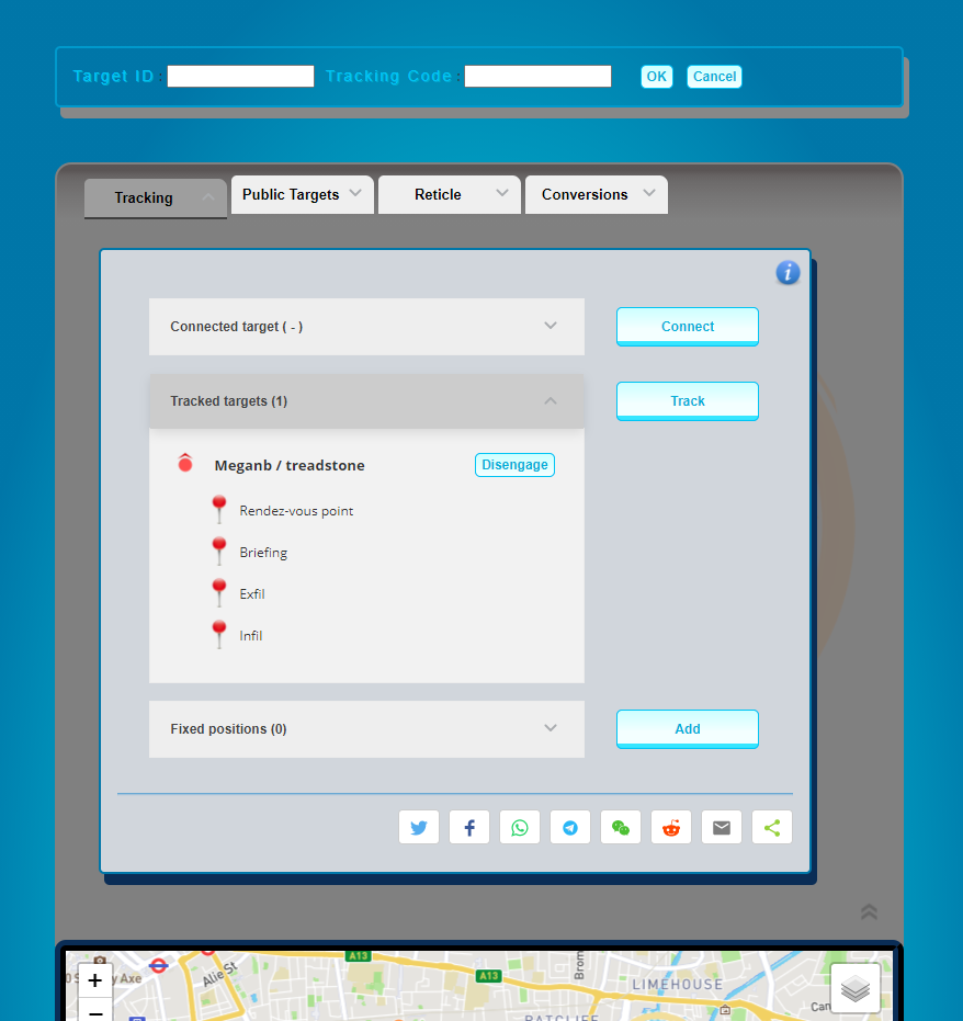
If you choose to Connect to a target instead, by also entering the Target Password, you will be able to edit the target as well as add & remove POIs.
To CREATE a new target, just connect to one which does not exist yet.
You can have as many Target IDs as you want, and also as many Tracking Codes per Target ID as you want. Each Target ID is unique, protected by the Target PWD.
Caution: Since LockOnMe does not require user accounts or email addresses, losing the Target PWD would mean losing the ability to connect to the related Target ID forever.
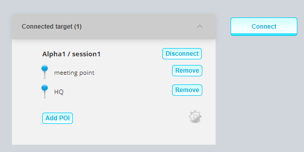
To add a Point Of Interest, click on Add POI in the Connected target section shown above. After choosing its spot on the map and entering a title, you’ll have the option of selecting an icon, writing a note, and specifying a website & an image URL.
The settings icon  opens up the target configuration dialog, where you will be able to delete the target or clear its recorded broadcast location:
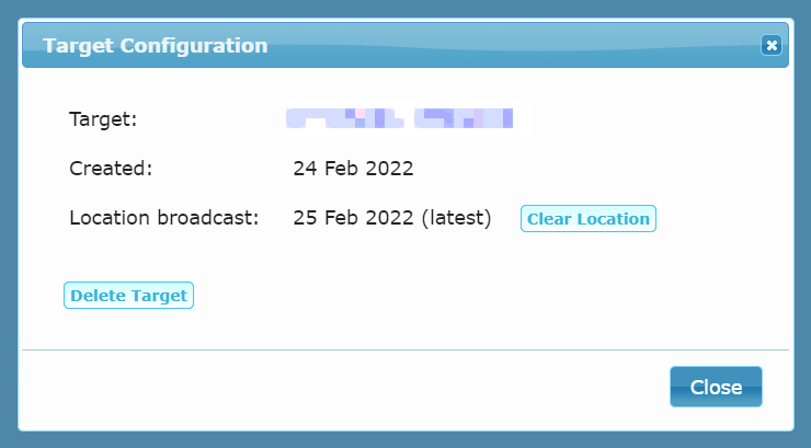
 (updated every 4 sec) – with an arrow indicating the direction which the target's device was oriented to. If you are tracking a target but see no red disk next to the target's details in the table, there isn't any record of a location broadcast.
The latest location broadcast of your connected target would appear as a blue disk
 .
.
The POIs of your connected target will often have a blue marker wrapper ![]() , and those of the tracked targets a red one
, and those of the tracked targets a red one ![]() .
.
Tactical POIs (whose icons are chosen from the 'tactical' category) do not follow that logic though, as blue and red convey a different meaning in that context. So they are all grey instead ![]() , and a star will mark the POIs of your own target
, and a star will mark the POIs of your own target ![]() .
.
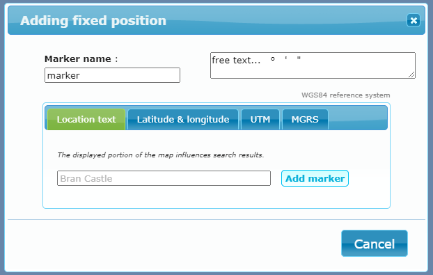
Apart from target-related markers, you can also add fixed positions  by directly right-clicking/long-pressing on the map, searching for a place using the lens icon, or entering Lat,Lon/UTM/MGRS coordinates or location text after clicking on Add fixed position, which would open up the following panel:
A fixed user position (shared from the mobile app) would appear as a red marker:  .
.
Public Targets represent a new way of sharing lists of places – as Points Of Interest (POIs) – with other people, as complement to the usual communication channels.
Live location broadcasts may be promoted in this way as well, for particular use cases (regatta, expedition, mobile ice cream van...).
In addition to having their dedicated tab in the WTC, Public Targets are also listed at lockon.me/publictargets![]() , and are featured in the mobile app (under Target Management System | Extras).
, and are featured in the mobile app (under Target Management System | Extras).
Public Targets are currently listed by geography:
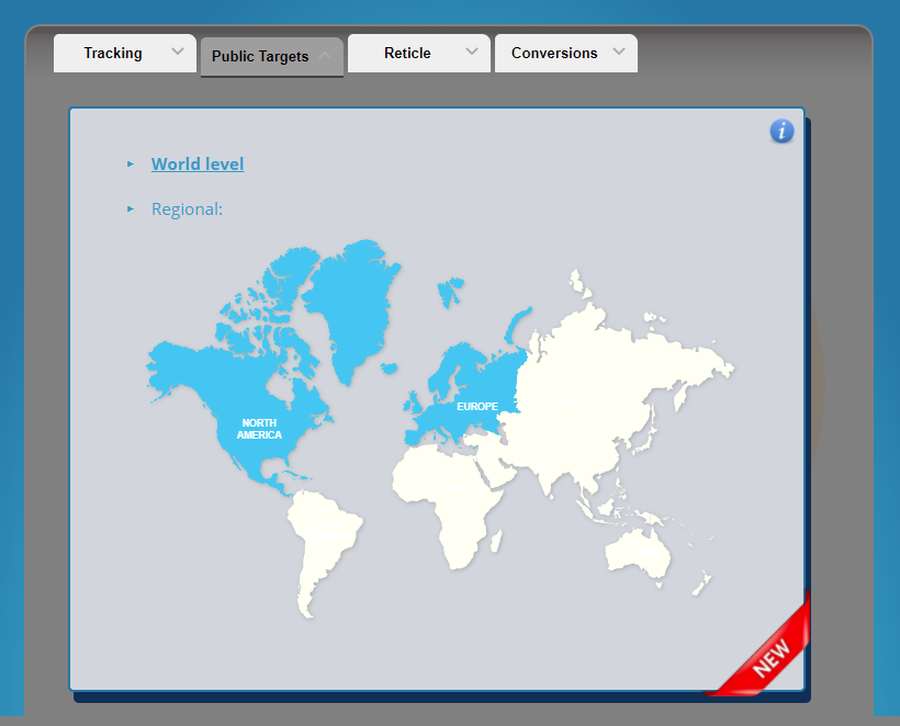
To get your target listed as public, write to PT@lockonme.com or hit us on X @lockonmeapp.
This tab displays the coordinates of the reticle situated in the middle of the map:
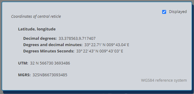
There you can also choose to hide the reticle via the check box – so as to get an unobstructed map view.
This tab offers a facility for converting coordinates between several geographic and Cartesian coordinate systems:
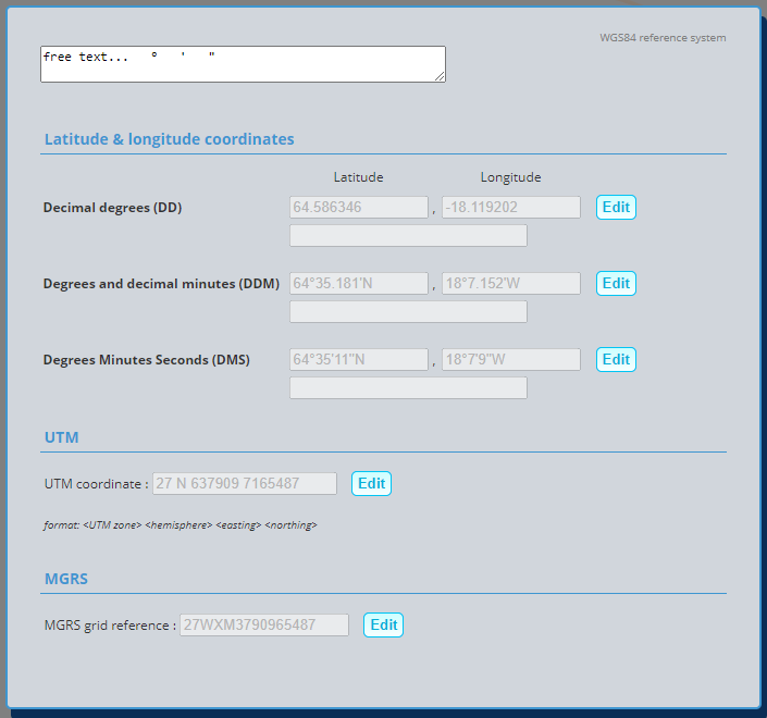
Click on one of the Edit buttons, input the base coordinates into the corresponding fields made available, and then click on Convert to see the result of the conversion in all other formats.
The free text field at the top is just that: a neutral field to paste coordinates from other sources and make use of the provided symbols to re-arrange them if need be. Once constructed in its proper form, the coordinate can then be copied into one of the fields beneath.
You can track some Public Targets to see how it looks like, as their POIs often have images.
By default, the carousel would show as a projector screen; to alternatively have it as a film reel, replace the above parameters with &carousel=reel or &carousel=reel-auto.
Contact us to request a key, and add similar code to your page in order to track your target:
<iframe src="https://lockon.me/embed?key=<YOUR_KEY>&track=(Meganb/treadstone)&map=MidCentury" allow="geolocation" allowfullscreen="" width="90%" height="500" style="border:none"></iframe>


